


 Dartmeet Clapper Bridge, Ruin
To view this item's National Grid Reference Number you need to be a subscriber. You can become a subscriber by visiting this page
Or login here if you are already a subscriber.
36 (1%) of Registered Dartefacters have visited this item. They are: DartyToni, bobfitzy62, SteveGrigg, CocosCrew, Chris Taylor, Pat, John Deakins, Peter Caton, Leo, Richard Blight, Steve Hill, Simon40, Lotti, mkcladi, dartefact, Celia Tanner, onlyonekirbs, Bridgemarker Tim, Fidget, maparle, H.Smyly, Beth Robotham, Amanda Ellis, Fr66, Sheron, haavl, Clanger, Max Piper, Neil Handley, softspeaker, BevDickinson, noisemonkey, Dartmoor Paul, ejt211, Torbagga, Ian Mayhew
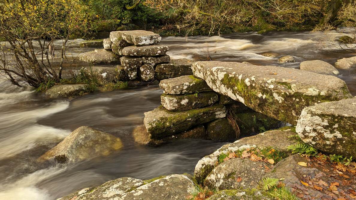
Notes: According to Eric Hemery in ‘High Dartmoor‘, p.563, “Crossing, in Amid Devonia’s Alps, gives 1826 as the year of its destruction by flood, and immense slabs, the collapsed former imposts, are seen wedged between boulders in the river.“
The map below is set to a maximum zoom of 1:50k. To zoom into the map further (1:25k) you need to be a subscriber. You can become a subscriber by visiting this page.
Or login here if you are already a subscriber.


