 Ryder’s Hill
To view this item's National Grid Reference Number you need to be a subscriber. You can become a subscriber by visiting this page
Or login here if you are already a subscriber.
40 (1%) of Registered Dartefacters have visited this item. They are: Dave Hamnett, Moreoutdoor, mkcladi, onlyonekirbs, ejt211, noisemonkey, CocosCrew, Richard Blight, RVC, Steve Hill, Simon40, John Deakins, Chris Taylor, nickstreet36, Pat, Gribbin, Steve Davison, davebates, John Paver, Peter Caton, dartefact, Neil Handley, Max Piper, The_greenman, Sheron, Amanda Ellis, Fr66, dougster, bobfitzy62, haavl, SteveGrigg, Torbagga, Partonez, ed-don, Beth Robotham, Clanger, BevDickinson, Paulmilsom, Dartmoor Paul, Fidget
This Dartefact is visited by the following walks: The Dartmoor 500 Challenge (Plus Extra “Bog Hoppers’ Peaks”) , km, m ascent
- The Holne Moorland Boundary Markers , km, m ascent
 The Dartmoor Dewey Challenge , km, 0 m ascent
 The 1240 Perambulation , km, m ascent
Notes: There is supposed to be a Rain Gauge somewhere on the slopes of this hill. A green one. So that should be easy to find..
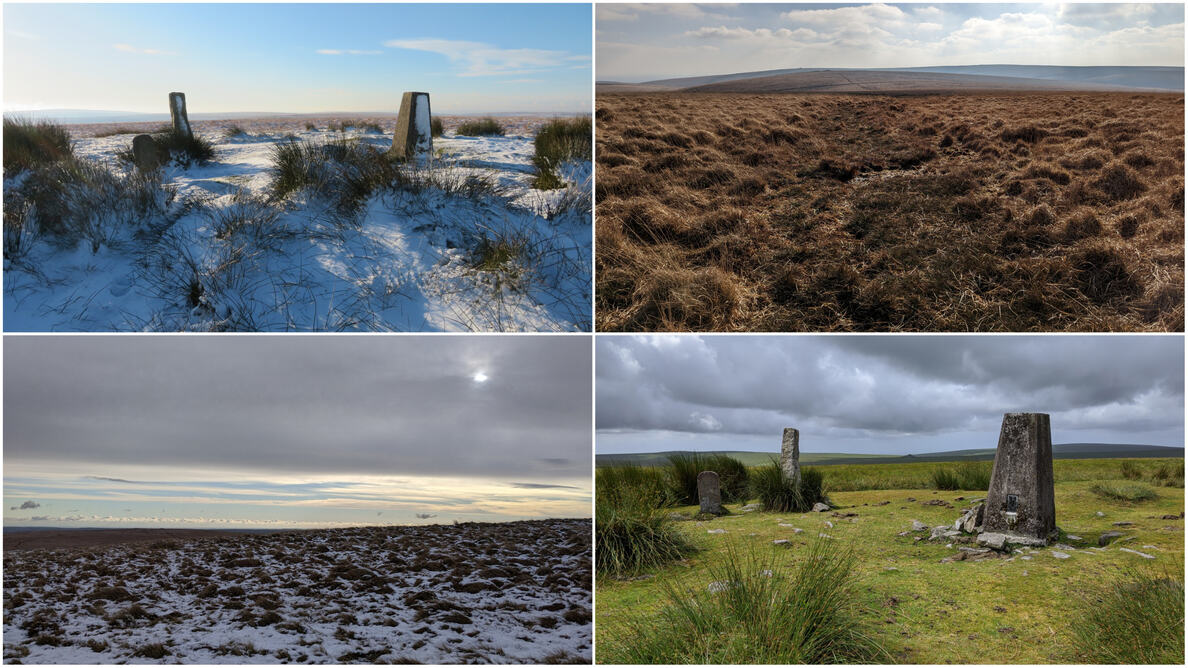
Ryder’s Hill is famed for being the highest summit on the South Moor, at 515m above sea level. It is a lonely spot that will require a boggy walk from any direction, and all paths in this area seem to lead to the trig point. From its summit is a panorama that on a clear day is tremendous; it is reputed that you can see Dodman Point near Mevagissey and the Isle of Portland. I can certainly claim seeing the latter but the former, it’s hard to tell.
There are two boundstones on the summit, the tall one inscribed B for Buckfastleigh and the smaller one H for Holne; this is the highest point in both parishes.
Further Reading: Tim Sandles, Legendary Dartmoor
The map below is set to a maximum zoom of 1:50k. To zoom into the map further (1:25k) you need to be a subscriber. You can become a subscriber by visiting this page.
Or login here if you are already a subscriber.


