 The Sea Level Stone
To view this item's National Grid Reference Number you need to be a subscriber. You can become a subscriber by visiting this page
Or login here if you are already a subscriber.
4 (0%) of Registered Dartefacters have visited this item. They are: Chris Taylor, Max Piper, CocosCrew, Dartmoor Paul
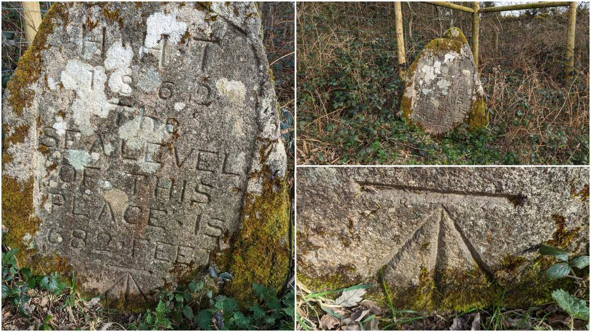
Acknowledgement: NGR and information kindly supplied by Christopher Taylor with Fiona Rothwell: “The inscription reads: H H T / 1862 / The / Sea Level / Of This / Place is / 682 Feet (HHT refers to Henry Hele Treby, who lived at Goodamoor House.)”
The stone had to be moved due to ongoing mining operations. Thanks to Mark Fenlon, the stone was repositioned (close to the Hemerdon Mine excavations where it would be safe) and there is a fabulous cut benchmark at the bottom. A public bridleway runs right up to this and provides an enjoyable route.
The map below is set to a maximum zoom of 1:50k. To zoom into the map further (1:25k) you need to be a subscriber. You can become a subscriber by visiting this page.
Or login here if you are already a subscriber.


