 Chudleigh Knighton ‘C’ County Stone
To view this item's National Grid Reference Number you need to be a subscriber. You can become a subscriber by visiting this page
Or login here if you are already a subscriber.
5 (0%) of Registered Dartefacters have visited this item. They are: Sheron, Max Piper, Amanda Ellis, cowauto, Bridgemarker Tim
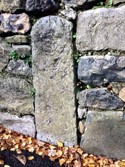
Acknowledgement: The original NGR and details for this item were kindly supplied by Sheron Vowden, as was the photograph to identify this county bridge stone which is sited between the church and a little brook, in a wall.
Max Piper: The other stone, which unlike this one is actually marked on old maps, has not been found. Bunker’s Bridge lies in between, and is assumed to have been rebuilt.
The map below is set to a maximum zoom of 1:50k. To zoom into the map further (1:25k) you need to be a subscriber. You can become a subscriber by visiting this page.
Or login here if you are already a subscriber.


