


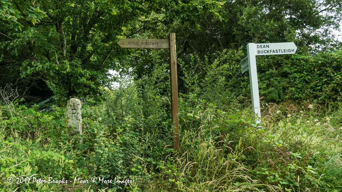
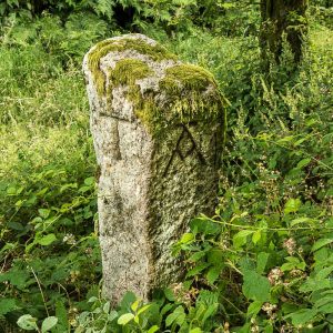
 Moor Cross (TATP Waymark Stone) (365, T15, pg349)
To view this item's National Grid Reference Number you need to be a subscriber. You can become a subscriber by visiting this page
Or login here if you are already a subscriber.
37 (1%) of Registered Dartefacters have visited this item. They are: Cbdarke, Dave Hamnett, rachfarley, JennyNatureWriter, cburridgebarney, delpez, ChrisHaigh1206, CocosCrew, The_greenman, Clanger, Joy Topping, Sarah Buck, Torbagga, Lynn Miller, simonb, Simon40, StewB, nickstreet36, Wbarritt, Steve Hill, Amanda Ellis, Peter Brooks, Karin B, tiamaria, SteveGrigg, Fr66, Max Piper, Ollismark, Sheron, Laviefish, BevDickinson, Neil Handley, Jamaine, Hadrian, Pat, Fidget, Dartmoor Paul

Reference: Tim Ferry
The ‘A’ looks like a version of the OS Bench Mark symbol – and there is a BM indicated on the old maps at this location. T=Tavistock, A= Ashburton, T=Totnes and P=Plymouth/Plympton or Plymstock? Pointed out by Tim Ferry.
The map below is set to a maximum zoom of 1:50k. To zoom into the map further (1:25k) you need to be a subscriber. You can become a subscriber by visiting this page.
Or login here if you are already a subscriber.


