 530 m Contour Ring, Eagle Rock, Steeperton Tor
To view this item's National Grid Reference Number you need to be a subscriber. You can become a subscriber by visiting this page
Or login here if you are already a subscriber.
19 (1%) of Registered Dartefacters have visited this item. They are: Torbagga, mkcladi, Gribbin, Dartmoor Paul, John Deakins, Bridgemarker Tim, PurpleDEV1L, Clanger, Fr66, noisemonkey, Max Piper, BevDickinson, Drinneevar, Neil Handley, bobfitzy62, Amanda Ellis, Beth Robotham, Fidget, SteveGrigg
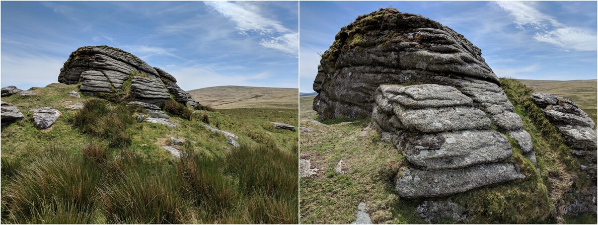
Notes: The southernmost and highest outcrop of Steeperton Tor is known as ‘Eagle Rock’, a large embedded outcrop with horizontal joints. This tops out at 532m above sea level with a good all-round view.
The map below is set to a maximum zoom of 1:50k. To zoom into the map further (1:25k) you need to be a subscriber. You can become a subscriber by visiting this page.
Or login here if you are already a subscriber.


