 Submerged Clapper Bridge, Knack Mine Ford
To view this item's National Grid Reference Number you need to be a subscriber. You can become a subscriber by visiting this page
Or login here if you are already a subscriber.
31 (1%) of Registered Dartefacters have visited this item. They are: Torbagga, dartefact, jeremy4444, onlyonekirbs, Steve Davison, Gribbin, nickstreet36, Cbdarke, SueRogers, Leo, John Deakins, tiamaria, Martin Brown, Simon40, PurpleDEV1L, mshere, Max Piper, CocosCrew, mkcladi, Clanger, Fr66, Neil Handley, noisemonkey, Amanda Ellis, Paulmilsom, SteveGrigg, Fidget, Dartmoor Paul, Pat, BevDickinson, Beth Robotham
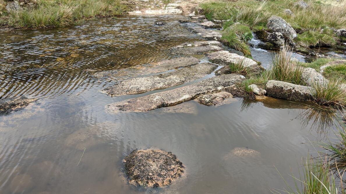
There is a submerged clapper bridge at Knack Mine Ford. Hemery (1983) writes: “The track crossing the river at Knack Mine Ford is an old peat road between Belstone and Hangingstone Hill, later utilized by the miners, who built the clapper bridge described by Crossing in 1908 as “partly ruined”. Its ruin has long been complete and the impost slabs now lie piled by the force of the river at its edge. Its dimensions when intact were recorded by Dr Arthur B. Prowse in 1889 as twenty-nine feet long, fifteen feet wide, of four openings and spanning the river obliquely – parallel to the paved ford, in fact.“
Reference:
- Hemery, E. (1983): High Dartmoor – Land and People
The photo was taken after a dry spell; the imposts normally aren’t visible above the water.
The map below is set to a maximum zoom of 1:50k. To zoom into the map further (1:25k) you need to be a subscriber. You can become a subscriber by visiting this page.
Or login here if you are already a subscriber.


