
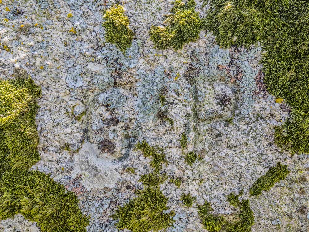
 Gidleigh/ Forest – BR No.07 Manga Rock (365, F11, pg83)
To view this item's National Grid Reference Number you need to be a subscriber. You can become a subscriber by visiting this page
Or login here if you are already a subscriber.
54 (2%) of Registered Dartefacters have visited this item. They are: Moreoutdoor, rachfarley, Baron Baskerville, paul glanville, Martin Brown, Mad1, Doc985, The_greenman, jeremy4444, JennyNatureWriter, Simon40, Joy Topping, Lotti, Clanger, CocosCrew, delpez, Fidget, simonb, Sarah Buck, John Deakins, Okehammer, davebates, nickstreet36, Gribbin, Chris Taylor, John Paver, Smiffys1975, Jbo, Wbarritt, bobfitzy62, Tinroofrusty, tiamaria, Max Piper, Karin B, Drinneevar, Amanda Ellis, Fr66, SteveGrigg, haavl, Evie and Me, Abster, Peter Brooks, mkcladi, Ollismark, Sheron, Beth Robotham, BevDickinson, dartefact, Neil Handley, Pat, Hadrian, noisemonkey, Torbagga, Dartmoor Paul
This Dartefact is visited by the following walks: Watern Tor from Fernworthy Forest , km, m ascent
 The Gidleigh Moorland Boundary Markers , km, m ascent

Inscribed into this rock on its North side are the letters G P – which stand for Gidleigh Parish.
The map below is set to a maximum zoom of 1:50k. To zoom into the map further (1:25k) you need to be a subscriber. You can become a subscriber by visiting this page.
Or login here if you are already a subscriber.


