


 Harford/ Ugborough – BS No.12 Black Pool
To view this item's National Grid Reference Number you need to be a subscriber. You can become a subscriber by visiting this page
Or login here if you are already a subscriber.
20 (1%) of Registered Dartefacters have visited this item. They are: Pat, Steve Hill, Richard Blight, John Deakins, StewB, nickstreet36, ChrisHaigh1206, Beth Robotham, Chris Taylor, Torbagga, Max Piper, CocosCrew, RVC, Fr66, BevDickinson, Fidget, SteveGrigg, Neil Handley, Dartmoor Paul, noisemonkey
This Dartefact is visited by the following walks:- The Ugborough Moorland Boundary Markers , km, m ascent
- The Harford Moorland Boundary Markers , km, m ascent
 Into the South Moor along Parish Boundaries and Rivers , km, m ascent
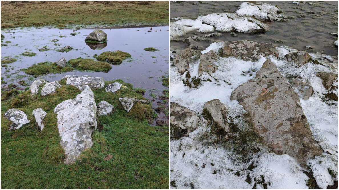
Steve Grigg, in February 2022, comments:
“Just a thought……is it possible that the Harford/Ugborough Parish Boundstone, No.12, in Black Pool is incorrectly labelled ?
Dartefacts suggests the boulder in the centre of Black Pool is the boundstone at SX65492 58122
Looking at 1873-1888 map it records a boundstone at SX65493 58115 at the southern edge of Black Pool.
The photograph I took today, shows (to me anyway) an obvious recumbent stone on the southern edge of Black Pool, which I recorded at SX65492 58115.
If you look at the photograph the recumbent stone is even surrounded by the classic small circle of stone, which helped keep it upright
(NOTE: there are other stones on this boundary which has the same feature).”
This description, which Max Piper believes to be accurate, would make the rock cluster in the image above the boundstone location and not, as first perceived, the lone boulder in the pool.
The map below is set to a maximum zoom of 1:50k. To zoom into the map further (1:25k) you need to be a subscriber. You can become a subscriber by visiting this page.
Or login here if you are already a subscriber.


