


 Erme Pound (365, S11, pg332)
To view this item's National Grid Reference Number you need to be a subscriber. You can become a subscriber by visiting this page
Or login here if you are already a subscriber.
46 (2%) of Registered Dartefacters have visited this item. They are: rachfarley, Moreoutdoor, Bob Davy, Baron Baskerville, paul glanville, John Clapham, Joy Topping, ChrisHaigh1206, Richard Blight, Ecky, dartefact, CocosCrew, Simon40, JennyNatureWriter, jeremy4444, Cvlucas, simonb, Sarah Buck, John Deakins, StewB, nickstreet36, John Paver, Wbarritt, Smiffys1975, Jbo, Amanda Ellis, tiamaria, Drinneevar, Karin B, SteveGrigg, Fr66, noisemonkey, Peter Brooks, Ollismark, Max Piper, Sheron, Pat, BevDickinson, Neil Handley, GlavindStrachan, Hadrian, Torbagga, Dartmoor Paul, Clanger, Fidget, Kbworth
This Dartefact is visited by the following walks:- The Harford Moorland Boundary Markers , km, m ascent
 Into the South Moor along Parish Boundaries and Rivers , km, m ascent
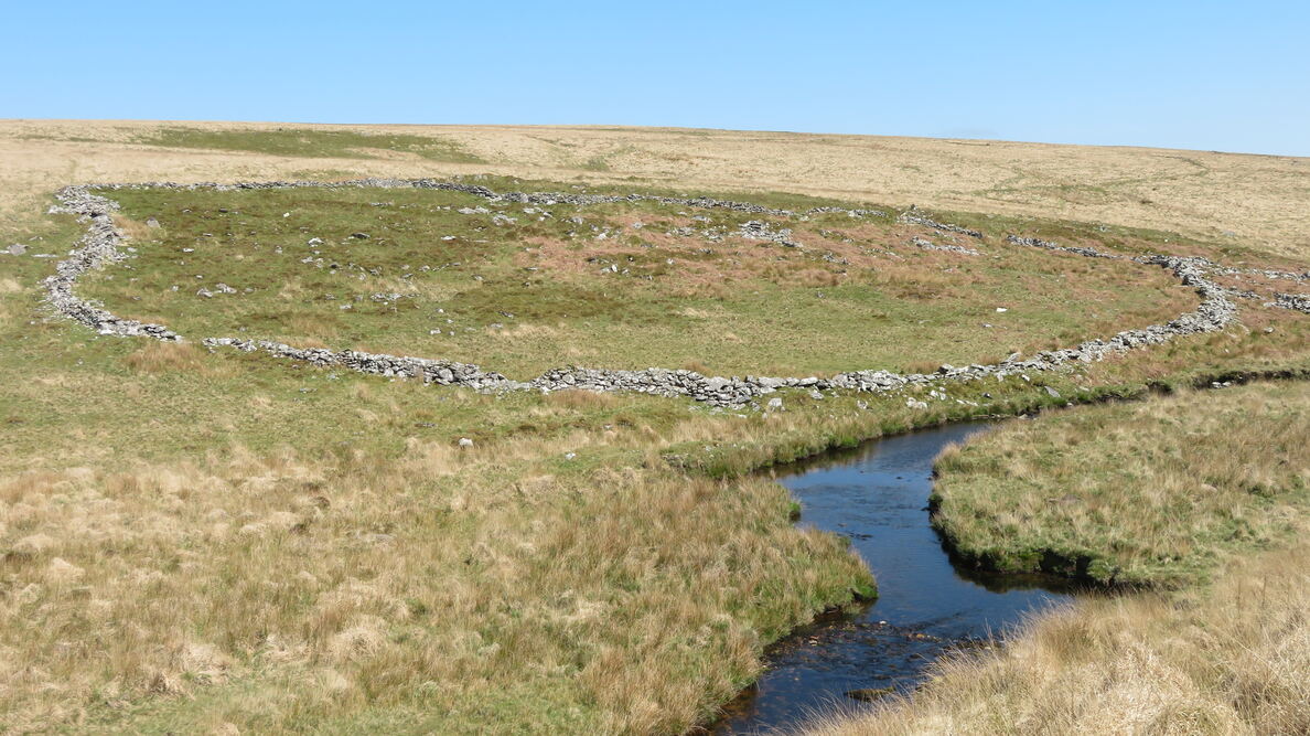
This is a magnificent enclosure above the left (east) bank of the Erme.
The map below is set to a maximum zoom of 1:50k. To zoom into the map further (1:25k) you need to be a subscriber. You can become a subscriber by visiting this page.
Or login here if you are already a subscriber.


