
 Hingston Hill (365, Q8, pg301)
To view this item's National Grid Reference Number you need to be a subscriber. You can become a subscriber by visiting this page
Or login here if you are already a subscriber.
68 (2%) of Registered Dartefacters have visited this item. They are: H.Smyly, Dave Hamnett, rachfarley, paul glanville, Baron Baskerville, Simon40, RVC, JennyNatureWriter, joCam, Chris Taylor, Leo, weelassie, walkingkj, Joy Topping, Clanger, Ale Drinking Wanderer, haavl, Ecky, Celia Tanner, BarefootinBude, onlyonekirbs, simonb, Sarah Buck, Steve Hill, Lynn Miller, John Deakins, nickstreet36, davebates, WaternMan, TavyPritch, DartyToni, Wbarritt, jeremy4444, John Paver, Smiffys1975, Jbo, Sheron, Peter Brooks, KeithRyan, maparle, The_greenman, Karin B, Max Piper, Mike Jeffery, Anne17, Drinneevar, Amanda Ellis, SteveGrigg, Fr66, bobfitzy62, Neil Handley, Ollismark, Jamaine, Beth Robotham, BevDickinson, Paulmilsom, Hadrian, noisemonkey, Torbagga, Fidget, Dartmoor Paul, mkcladi, Mad1, Pat, delpez, DartmoorFromAnAutisticPerspective, ChrisHaigh1206, CocosCrew
This Dartefact is visited by the following walks: Norsworthy Bridge to Hingston Hill Stone Row , km, m ascent
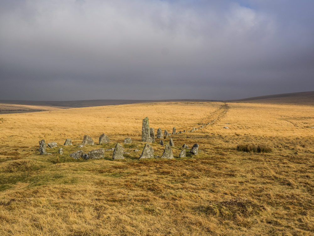
Notes: Hingstone Hill is rather open, rounded and scattered with clitter all over the place. Dartmoor 365 uses the name to refer to the Prehistoric items nearby.
The map below is set to a maximum zoom of 1:50k. To zoom into the map further (1:25k) you need to be a subscriber. You can become a subscriber by visiting this page.
Or login here if you are already a subscriber.


