



 Ruined building by ‘Old Sand Pit’
To view this item's National Grid Reference Number you need to be a subscriber. You can become a subscriber by visiting this page
Or login here if you are already a subscriber.
19 (1%) of Registered Dartefacters have visited this item. They are: Fr66, Jasskurn, noisemonkey, John Deakins, Dartmoor Paul, Torbagga, Fidget, Amanda Ellis, CocosCrew, BevDickinson, Peter Brooks, Neil Handley, Sheron, Beth Robotham, Peter Caton, Max Piper, Karin B, Mike Jeffery, KeithRyan
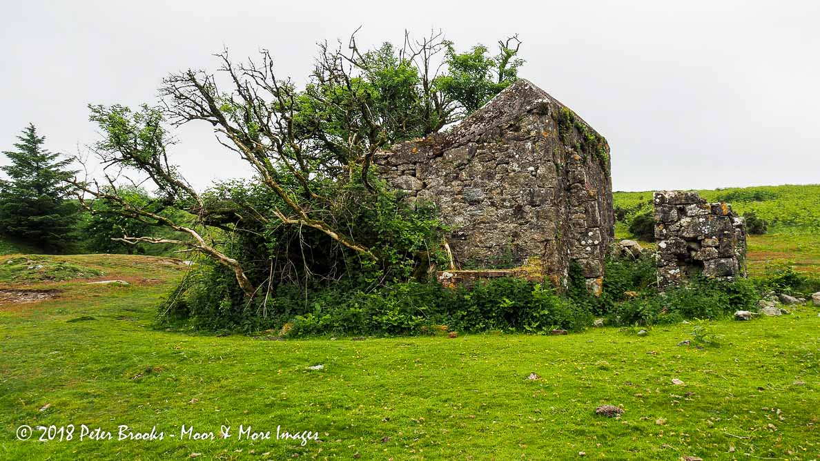
 Notes: The building is not identified on the current OS map. Old maps refer to the ‘Old Sand Pit’ that is situated nearby. It has been suggested that it was originally a workmans hut or an explosive store.
Mark Fenlon: “The 1886 Ordnance Survey map 25-inch, shows a rifle range on Welstor Down. With the targets near to the ‘Ruined building’. Also shown on that map are distance markers to the shooting positions, that emanate northwards from the targets. Most are inside the enclosure but one set are north of the wall. I am unaware of any research papers on this range, so cannot say if any of the distance markers still exist. This information might help to explain the ‘ruined building’.”
The map below is set to a maximum zoom of 1:50k. To zoom into the map further (1:25k) you need to be a subscriber. You can become a subscriber by visiting this page.
Or login here if you are already a subscriber.


