 B.M. 1580.5, SF, Petre’s Cross, Western White Barrow (479 m)
To view this item's National Grid Reference Number you need to be a subscriber. You can become a subscriber by visiting this page
Or login here if you are already a subscriber.
8 (0%) of Registered Dartefacters have visited this item. They are: Max Piper, dartefact, Peter Brooks, SteveGrigg, Pat, Fr66, Torbagga, John Deakins
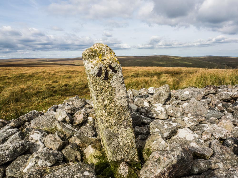
Notes: Found on Tuesday 21st September 2021 by Rob Naylor with Peter Brooks. After some pretty fruitless searching around the cairn I decided to take a look at the ridiculously leaning Petre’s Cross. I had ignored it up to then as a suitable location for a B.M. owing to its crazy leaning angle. I figured no surveyor would consider placing a B.M. on a upright stone that was clearly going to fall. Of course back when it was selected it was probably perfectly vertical and looked set to be upright for a long time to come? It is on the south face and just below a ledge that that would be perfect for a Surveyor to take a height reading. Although worn due to erosion (it’s very exposed up here) the cut marks were surprisingly clear – and as can be seen in the photo below it readily took to being mud painted! Even the divot at the top (where the level would have been placed) got its share of mud today! RN
Reference: Side by Side
The map below is set to a maximum zoom of 1:50k. To zoom into the map further (1:25k) you need to be a subscriber. You can become a subscriber by visiting this page.
Or login here if you are already a subscriber.


