To view this item's National Grid Reference Number you need to be a subscriber. You can become a subscriber by visiting this page
Or login here if you are already a subscriber.
10 (0%) of Registered Dartefacters have visited this item. They are: Max Piper, Amanda Ellis, SteveGrigg, noisemonkey, Neil Handley, dartefact, BevDickinson, Pat, John Deakins, Steve Hill

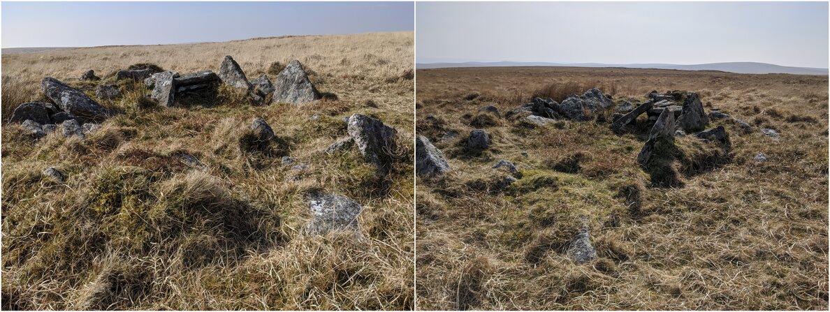
After making an enquiry on Facebook, it is thought with certainty that this ruin is a peat cutters’ shelter. Nearby Moute’s Inn also served the same purpose.
With thanks to Dave Parks for supplying the following information from Dartmoor HER: “SX 61658523. A ruinous structure situated in an area which has been extensively worked for peat on the crest of the ridge running south from Hangingstone Hill. The feature is as described in 1979 (Ordnance Survey) though the interior is partially obscured by the collapsed walls. This structure probably functioned as a shelter or habitation for peat-cutters working the surrounding peat deposits. The remains of three other buildings of similar function (SX 68 NW 27, 33 and 34) lie in the general area (citing Probert, S. A. J., 02/09/1993, Royal Commission on the Historic Monuments in England Field Investigation).“
The ruin, which to Max Piper resembled a cairn/kistvaen, is just to the west of the ridge path between Whitehorse Hill and Quintin’s Man, though much closer to the former. Whitehorse Hill is famous for its kistvaen on the summit and there is some suggestion that the peat cutters’ hut here was moulded out of a cairn… because why create a new structure when there’s already a half-decent foundation in place?
The map below is set to a maximum zoom of 1:50k. To zoom into the map further (1:25k) you need to be a subscriber. You can become a subscriber by visiting this page.
Or login here if you are already a subscriber.

 Whitehorse Hill Peat Cutters’ Shelter


