


 Cut Lane (Peat Pass)
To view this item's National Grid Reference Number you need to be a subscriber. You can become a subscriber by visiting this page
Or login here if you are already a subscriber.
19 (1%) of Registered Dartefacters have visited this item. They are: Dartmoor Paul, bobno, noisemonkey, CocosCrew, lizmiall, Bridgemarker Tim, John Deakins, Dartmoor Chris, Kbworth, The_greenman, SteveGrigg, BevDickinson, Peter Caton, Amanda Ellis, Fr66, Max Piper, Neil Handley, Dave Isherwood, Baron Baskerville
Cut Lane is not a Frank Phillpotts’ peat pass and is not marked by any plaques at either end. Instead, this pass was created by moormen as a drier, safer passage between East Dart Country and Tavy Country; a narrowing of the great north to south plateau from Okement Hill to Devil’s Tor where better terrain exists in Cut Lane Stream and Rush Bottom. The length of the peat pass is not entirely clear as a clear path extends to the south-east towards Hangman’s Stream Foot, passing Cut Hill Outcrop.
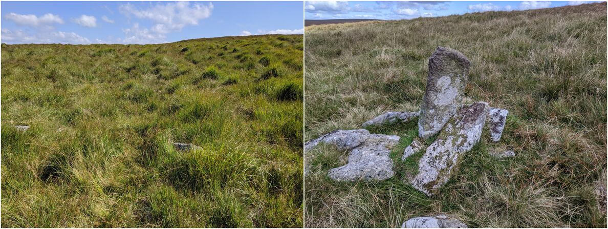
At the western end of the pass as marked on Ordnance Survey maps, there are scattered rocks and a number of upright stones… obviously placed by hand, these must exist to guide the traveller.
The map below is set to a maximum zoom of 1:50k. To zoom into the map further (1:25k) you need to be a subscriber. You can become a subscriber by visiting this page.
Or login here if you are already a subscriber.


